Teams at Eltham College were facing the issue of visualising the addresses in their database. The outreach team wanted to be able to identify applicant and alumni hotspots to better plan events for the school community. Simply looking at the addresses in the database wasn't sufficient. Furthermore, the team was weary about using 3rd party solutions that might compromise the privacy of students/alumni.
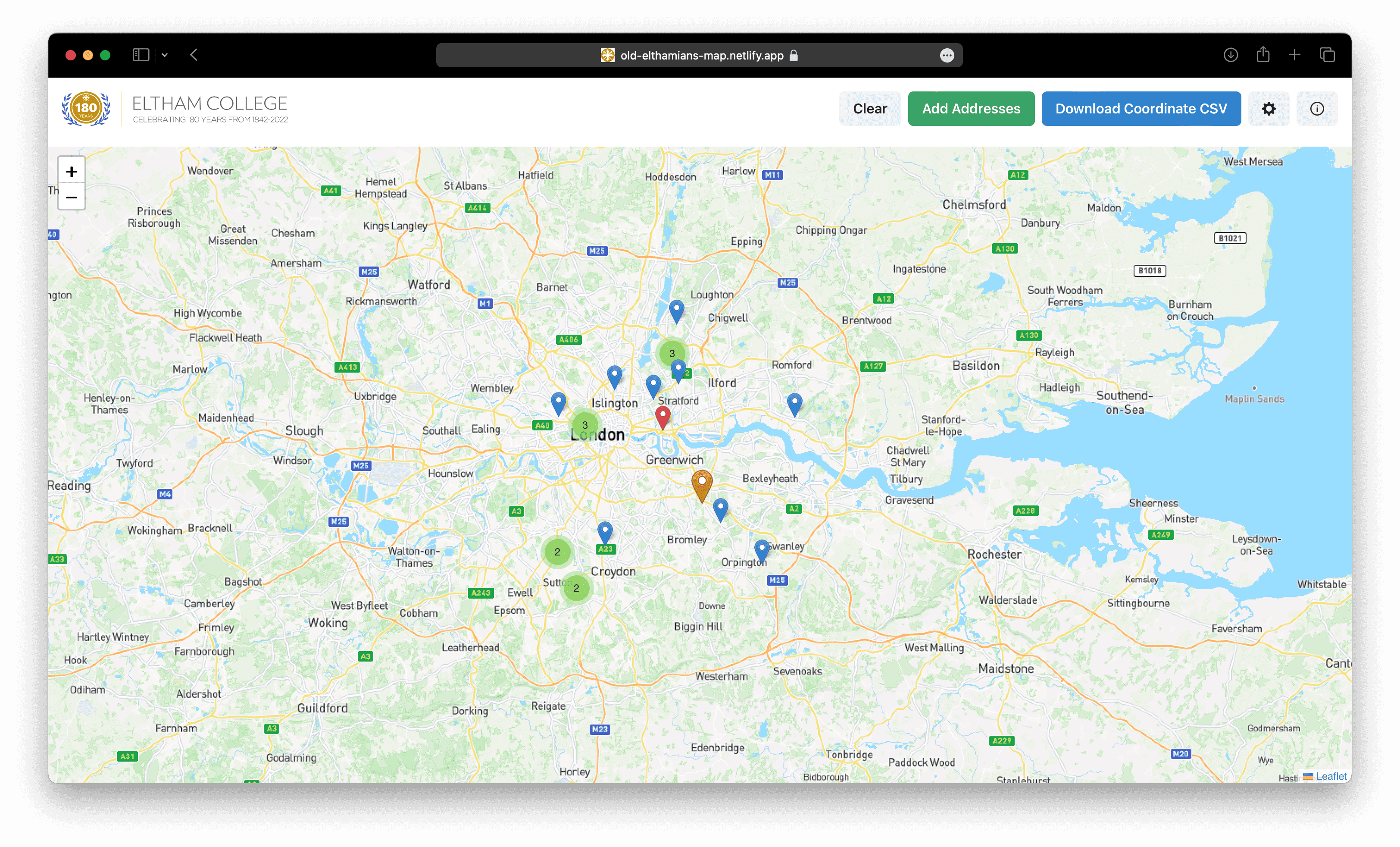
Using geocoding APIs and the Leaflet.js library, I built a custom solution for them. The small website takes in a CSV of students (exported from their database) and plots their addresses. By selecting a database field, multiple datasets can be overlaid to view trends of applicant locations between years. All the data stays in the browser, except for geocoding which sends only a UUID and the address to avoid any personal data being transmitted. This allows the team to stay within their data privacy requirements.
